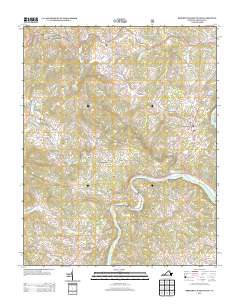
2013 Map of Brierpatch Mountain
USGS Topo · Published 2013About this map
The New River defines the southern portion of this Grayson County landscape, winding past the riverside community of Riverside and the settlement of Carsonville. This 2013 U.S. Geological Survey record reveals a rural terrain where the industrial past is still marked by sites like Catrons Mill and Clito Mill. The area north of the river is a network of named peaks and hollows, including the prominent Brierpatch Mountain and the distinctive summit of The Pilot.
Find a feature on this map
83 named features on this map. Tap any name to fly to it.
Don’t see what you’re looking for? This feature index may not catch every label — zoom into the map to look around manually.
Map Details
Editions of this 2013 Brierpatch Mountain Map
This is the sole edition of this map. No revisions or reprints were ever made.
Other maps of this area

1889 · Hillsville
USGS Topo · 1:125,000

1889 · Wytheville
USGS Topo · 1:125,000

1892 · Hillsville
USGS Topo · 1:125,000

1892 · Wytheville
USGS Topo · 1:125,000

1896 · Hillsville
USGS Topo · 1:125,000

1930 · Speedwell
USGS Topo · 1:62,500

1930 · Independence
USGS Topo · 1:48,000

1930 · Max Meadows
USGS Topo · 1:62,500

1931 · Galax
USGS Topo · 1:48,000

1933 · Independence
USGS Topo · 1:62,500