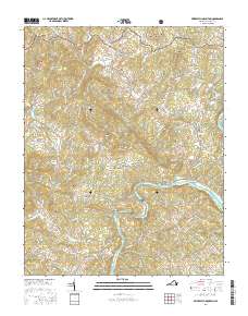
2016 Map of Brierpatch Mountain
USGS Topo · Published 2016About this map
The New River carves a deep path through this section of the Blue Ridge, anchoring a landscape defined by isolated summits and small mountain communities. Settlements like Fallville, Spring Valley, and Carsonville are connected by a network of winding mountain roads such as Carsonville Rd and Jerusalem Rd, which follow the natural contours of the high ground between Knob Fork and Elk Creek. The presence of several family-centric burial grounds, including Jerusalem Cem and Warrick Cem, indicates deep-rooted mountain genealogies.
Find a feature on this map
116 named features on this map. Tap any name to fly to it.
Don’t see what you’re looking for? This feature index may not catch every label — zoom into the map to look around manually.
Map Details
Editions of this 2016 Brierpatch Mountain Map
This is the sole edition of this map. No revisions or reprints were ever made.
Other maps of this area

1889 · Hillsville
USGS Topo · 1:125,000

1889 · Wytheville
USGS Topo · 1:125,000

1892 · Hillsville
USGS Topo · 1:125,000

1892 · Wytheville
USGS Topo · 1:125,000

1896 · Hillsville
USGS Topo · 1:125,000

1930 · Speedwell
USGS Topo · 1:62,500

1930 · Independence
USGS Topo · 1:48,000

1930 · Max Meadows
USGS Topo · 1:62,500

1931 · Galax
USGS Topo · 1:48,000

1933 · Independence
USGS Topo · 1:62,500