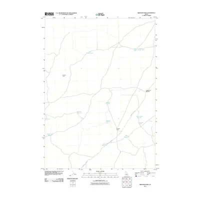
2010 Map of Brigham Point
USGS Topo · Published 2010About this map
Brigham Point and the prominent rising of Whiskey Butte anchor this high-desert landscape in Blaine County during the early 21st century. The geography is defined by its water management systems and remote intersections, most notably Cream Can Junction in the eastern portion of the quadrangle. A network of reservoirs and ephemeral water bodies, including Gabettas Reservoir, Big Sinks Reservoir, and Antelope Reservoir, suggests a landscape utilized for livestock grazing and seasonal water catchment. The historical Minidoka to Arco Rd traverses the southern terrain, connecting the basin through a series of namesake lakes such as Split Road Lake and Split Butte Lake. This survey provides a clear look at the hydraulic infrastructure of the region, from the Section Corner Reservoir to the aptly named Crossroad Lake.
Find a feature on this map
16 named features on this map. Tap any name to fly to it.
Don’t see what you’re looking for? This feature index may not catch every label — zoom into the map to look around manually.
Map Details
Editions of this 2010 Brigham Point Map
This is the sole edition of this map. No revisions or reprints were ever made.
Other maps of this area

1954 · Pocatello
USGS Topo · 1:250,000

1955 · Idaho Falls
USGS Topo · 1:250,000

1958 · Idaho Falls
USGS Topo · 1:250,000

1958 · Pocatello
USGS Topo · 1:250,000

1972 · Schodde Well
USGS Topo · 1:24,000

1972 · Bear Trap Cave
USGS Topo · 1:24,000

1972 · Mule Butte
USGS Topo · 1:24,000

1972 · Bear Park SW
USGS Topo · 1:24,000

1972 · Minidoka
USGS Topo · 1:24,000

1972 · Max
USGS Topo · 1:24,000