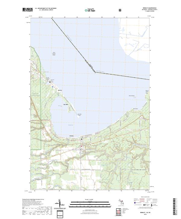
2023 Map of Brimley
USGS Topo · Published 2023About this map
Mission and the settlement of Bay Mills stand at the southern edge of Waiska Bay in this recent record of Michigan's Upper Peninsula. Situated along the international boundary in the Saint Marys River, this landscape is defined by its deep cultural and educational roots, featuring the Bay Mills Community College and the Old Indian Burial Ground. The terrain transitions from the low-lying wetlands of Back Bay to the rising timberlands of the Hiawatha National Forest, where drainage networks like Little Waiska Creek and North Branch Orrs Creek weave through the interior. In Brimley, the concentration of local infrastructure and the presence of the Bayview Cem reflect a community long tied to the waterfront and the surrounding forest, while landmarks such as Birch Point and Round Island Point mark the transition into the open waters of Lake Superior.
Find a feature on this map
52 named features on this map. Tap any name to fly to it.
Don’t see what you’re looking for? This feature index may not catch every label — zoom into the map to look around manually.
Map Details
Editions of this 2023 Brimley Map
This is the sole edition of this map. No revisions or reprints were ever made.
Other maps of this area

1913 · Sault Sainte Marie
USGS Topo · 1:62,500

1941 · Sault Sainte Marie
USGS Topo · 1:63,360

1941 · Brimley
USGS Topo · 1:63,360

1951 · Shallows
USGS Topo · 1:24,000

1951 · Dollar Settlement
USGS Topo · 1:24,000

1951 · Raco
USGS Topo · 1:24,000

1951 · Kinross
USGS Topo · 1:24,000

1951 · Dafter
USGS Topo · 1:24,000

1951 · Brimley
USGS Topo · 1:62,500

1951 · Sault Ste. Marie
USGS Topo · 1:62,500