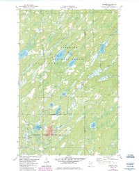
1981 Map of Brimson
USGS Topo · Published 1985About this map
The Cloquet River winds through a landscape of dense forests and glacial lakes in this mapping of the borderlands between St Louis and Lake counties. Small communities like Brimson and Rollins anchor the settlement pattern, alongside institutional landmarks such as the Rhema Fellowship Sch and Camp F E House. The map documents the overlap of the Superior National Forest and Cloquet Valley State Forest, where the terrain is marked by significant hydrological features including Indian Lake, George Lake, and Breda Lake.
Find a feature on this map
40 named features on this map. Tap any name to fly to it.
Don’t see what you’re looking for? This feature index may not catch every label — zoom into the map to look around manually.
Map Details
Editions of this 1981 Brimson Map
2 editions found
Other maps of this area

1953 · Whyte
USGS Topo · 1:62,500

1954 · Two Harbors
USGS Topo · 1:250,000

1956 · Pequaywan Lake
USGS Topo · 1:24,000

1956 · King Lake
USGS Topo · 1:24,000

1957 · Two Harbors
USGS Topo · 1:250,000

1957 · Two Harbors
USGS Topo · 1:62,500

1957 · Brimson
USGS Topo · 1:62,500

1958 · Two Harbors
USGS Topo · 1:250,000

1964 · Two Harbors
USGS Topo · 1:250,000
1976 · Brimson SW
USGS Topo · 1:24,000