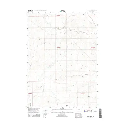
2015 Map of Bringolf Ranch
USGS Topo · Published 2015About this map
Bringolf Ranch sits as a central landmark within this expansive Fremont County landscape, situated along the namesake Bringolf Rd. The terrain is defined by an intricate network of drainage systems, most notably Beaver Cr, which meanders through the central and western sections of the quadrangle. This hydraulic pattern is further shaped by numerous named draws including Ninemile Draw, Big Sand Draw, and Little Sand Draw, illustrating the erosional forces that have carved the high plains. In the southeast, the elevation rises toward McTurk Ridge and the adjacent McTurk Draw. The infrastructure of the area in 2015 remains focused on ranching and access, with prominent routes such as Beaver Creek Rd and Sand Draw Rd providing the primary connectivity across the various township and range sections.
Find a feature on this map
18 named features on this map. Tap any name to fly to it.
Don’t see what you’re looking for? This feature index may not catch every label — zoom into the map to look around manually.
Map Details
Editions of this 2015 Bringolf Ranch Map
This is the sole edition of this map. No revisions or reprints were ever made.
Other maps of this area

1953 · Arapahoe NE
USGS Topo · 1:24,000

1953 · Ninemile Hill
USGS Topo · 1:24,000

1953 · Bringolf Ranch
USGS Topo · 1:24,000

1953 · Arapahoe
USGS Topo · 1:24,000

1953 · Sand Draw
USGS Topo · 1:24,000

1953 · Dishpan Butte
USGS Topo · 1:24,000

1953 · Del Monte Ridge
USGS Topo · 1:24,000

1953 · Yellowstone Ranch
USGS Topo · 1:24,000

1955 · Lander
USGS Topo · 1:250,000

1958 · Lander
USGS Topo · 1:250,000