
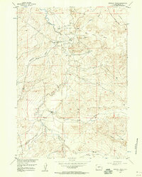
1953 Map of Sand Draw
USGS Topo · Published 1954About this map
Big Sand Draw Oil and Gas Field dominates this 1953 industrial landscape in Fremont County, Wyoming, revealing the intensive resource extraction shaping the region. The map details the infrastructure of the era, including an Airfield, clusters of Oil Tanks, and various pipe and telephone lines that supported the booming energy sector. The settlement of Sand Draw appears as a hub of activity, surrounded by petroleum units like the North Sand Draw Unit and the Alkali Butte Unit.
Find a feature on this map
19 named features on this map. Tap any name to fly to it.
Don’t see what you’re looking for? This feature index may not catch every label — zoom into the map to look around manually.
Map Details
Editions of this 1953 Sand Draw Map
This is the sole edition of this map. No revisions or reprints were ever made.
Other maps of this area

1953 · Blue Gulch
USGS Topo · 1:24,000

1953 · Arapahoe NE
USGS Topo · 1:24,000

1953 · Bringolf Ranch
USGS Topo · 1:24,000

1953 · Elkhorn Springs
USGS Topo · 1:24,000

1953 · Campbell Ridge
USGS Topo · 1:24,000

1953 · Dishpan Butte
USGS Topo · 1:24,000

1953 · Yellowstone Ranch
USGS Topo · 1:24,000

1955 · Lander
USGS Topo · 1:250,000

1958 · Lander
USGS Topo · 1:250,000
1958 · Bringolf Ranch
USGS Topo · 1:24,000