
1953 Map of Dishpan Butte
USGS Topo · Published 1955About this map
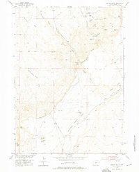
Big Sand Draw Oil and Gas Field dominates the northern landscape of this mid-century survey, marked by a network of Oil Wells, Gas Wells, and an Oil Tank. This industrial development is bounded to the south by the prominent escarpment of Beaver Rim, a significant geological divide that separates the oil-rich flats from the complex drainage systems below. South of the rim, the terrain is defined by dramatic elevation changes and a series of seasonal watercourses and natural springs.
Find a feature on this map
18 named features on this map. Tap any name to fly to it.
Don’t see what you’re looking for? This feature index may not catch every label — zoom into the map to look around manually.
Map Details
Editions of this 1953 Dishpan Butte Map
3 editions found
Other maps of this area

1951 · Myers Ranch
USGS Topo · 1:24,000

1953 · Blue Gulch
USGS Topo · 1:24,000

1953 · Bringolf Ranch
USGS Topo · 1:24,000

1953 · Sweetwater Station
USGS Topo · 1:24,000

1953 · Elkhorn Springs
USGS Topo · 1:24,000

1953 · Sand Draw
USGS Topo · 1:24,000

1953 · Yellowstone Ranch
USGS Topo · 1:24,000

1953 · Red Canyon
USGS Topo · 1:24,000

1955 · Lander
USGS Topo · 1:250,000
1957 · Red Canyon
USGS Topo · 1:24,000