
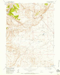
1953 Map of Red Canyon
USGS Topo · Published 1955About this map
The Oregon Trail cuts across the southeastern corner of this landscape, marking a historic corridor of western migration through the high plains of Wyoming. This mid-century survey captures a terrain defined by the dramatic escarpment of Beaver Rim, which separates the higher plateau from the erosion-carved basin below. The topography is dominated by deep drainages like Red Canyon and Rocky Draw, showing a rugged environment where water sources were critical for both wildlife and travelers. Water management is evident through the presence of Antelope Springs Reservoir and Jackson Reservoir, alongside natural seeps like Jackson Spring and Bain Spring. Small landmarks such as the Shelter House near Cottonwood Creek suggest the sparse but essential human presence in this grazing and transit territory during the early 1950s.
Find a feature on this map
15 named features on this map. Tap any name to fly to it.
Don’t see what you’re looking for? This feature index may not catch every label — zoom into the map to look around manually.
Map Details
Editions of this 1953 Red Canyon Map
This is the sole edition of this map. No revisions or reprints were ever made.
Other maps of this area

1953 · Lewiston Lakes
USGS Topo · 1:24,000

1953 · Barras Springs
USGS Topo · 1:24,000

1953 · Sweetwater Station
USGS Topo · 1:24,000

1953 · Happy Spring
USGS Topo · 1:24,000

1953 · Schlichting Mountain
USGS Topo · 1:24,000

1953 · Dishpan Butte
USGS Topo · 1:24,000

1953 · Del Monte Ridge
USGS Topo · 1:24,000

1953 · Yellowstone Ranch
USGS Topo · 1:24,000

1955 · Lander
USGS Topo · 1:250,000
1957 · Red Canyon
USGS Topo · 1:24,000