
1953 Map of Happy Spring
USGS Topo · Published 1954About this map
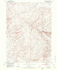
The Green Mountains dominate this high-desert landscape in Fremont County, where seasonal water sources dictate the patterns of human activity. The presence of the Happy Spring Sheep Camp near its namesake Happy Spring reflects the era's reliance on open-range grazing in the Wyoming interior. This survey, conducted as part of the Department of the Interior program for the development of the Missouri River Basin, documents the complex drainage systems of Alkali Creek and West Alkali Creek as they wind through the Bison Basin. To the north, Warm Springs and several unnamed springs emerge from the breaks of Bull Canyon, providing critical relief in an otherwise arid environment. The map captures a moment of transition for the region, showing the established Bison Basin Road as it passes through terrain that would soon be more heavily defined by petroleum exploration in the nearby oil fields.
Find a feature on this map
16 named features on this map. Tap any name to fly to it.
Don’t see what you’re looking for? This feature index may not catch every label — zoom into the map to look around manually.
Map Details
Editions of this 1953 Happy Spring Map
2 editions found
Other maps of this area

1951 · Soap Holes
USGS Topo · 1:24,000

1951 · Myers Ranch
USGS Topo · 1:24,000

1953 · Barras Springs
USGS Topo · 1:24,000

1953 · Sweetwater Station
USGS Topo · 1:24,000

1953 · Red Canyon
USGS Topo · 1:24,000

1955 · Lander
USGS Topo · 1:250,000
1957 · Red Canyon
USGS Topo · 1:24,000

1958 · Lander
USGS Topo · 1:250,000

1961 · Lander
USGS Topo · 1:250,000
1961 · Lost Creek Reservoir
USGS Topo · 1:24,000