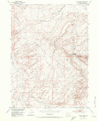
1953 Map of Happy Spring
USGS Topo · Published 1972About this map
Crooks Mountain dominates the center of this Wyoming high-desert landscape, recorded during the mid-century as part of the Missouri River Basin development program. The terrain is defined by a series of drainages, including Alkali Creek, West Alkali Creek, and the deep cut of Bull Canyon. These water sources were critical for the regional livestock industry, evidenced by the presence of the Happy Spring Sheep Camp located near the eponymous Happy Spring.
Find a feature on this map
12 named features on this map. Tap any name to fly to it.
Don’t see what you’re looking for? This feature index may not catch every label — zoom into the map to look around manually.
Map Details
Editions of this 1953 Happy Spring Map
2 editions found
Other maps of this area

1951 · Soap Holes
USGS Topo · 1:24,000

1951 · Myers Ranch
USGS Topo · 1:24,000

1953 · Barras Springs
USGS Topo · 1:24,000

1953 · Sweetwater Station
USGS Topo · 1:24,000

1953 · Happy Spring
USGS Topo · 1:24,000

1953 · Red Canyon
USGS Topo · 1:24,000

1955 · Lander
USGS Topo · 1:250,000
1957 · Red Canyon
USGS Topo · 1:24,000

1958 · Lander
USGS Topo · 1:250,000

1961 · Lander
USGS Topo · 1:250,000