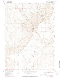
1953 Map of Dishpan Butte
USGS Topo · Published 1979About this map
Beaver Divide dominates the high ground of this Fremont County landscape, marking a significant topographic transition between the drainages of the Big Sand Draw Oil and Gas Field to the north and the expansive Government Meadows Draw to the south. The 1953 field check captures an era of active resource extraction, evidenced by numerous gas and oil wells dotting the northern plains.
Find a feature on this map
23 named features on this map. Tap any name to fly to it.
Don’t see what you’re looking for? This feature index may not catch every label — zoom into the map to look around manually.
Map Details
Editions of this 1953 Dishpan Butte Map
3 editions found
Other maps of this area

1951 · Myers Ranch
USGS Topo · 1:24,000

1953 · Blue Gulch
USGS Topo · 1:24,000

1953 · Bringolf Ranch
USGS Topo · 1:24,000

1953 · Sweetwater Station
USGS Topo · 1:24,000

1953 · Elkhorn Springs
USGS Topo · 1:24,000

1953 · Sand Draw
USGS Topo · 1:24,000

1953 · Dishpan Butte
USGS Topo · 1:24,000

1953 · Yellowstone Ranch
USGS Topo · 1:24,000

1953 · Red Canyon
USGS Topo · 1:24,000

1955 · Lander
USGS Topo · 1:250,000