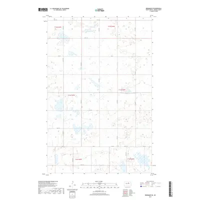
2017 Map of Brinsmade SW
USGS Topo · Published 2017About this map
Glacial potholes and small prairie wetlands dominate the landscape of Benson County in this recent survey. The terrain is defined by a high density of water bodies scattered across the Public Land Survey System townships of t154n r69w, t154n r68w, and t152n r68w. This township-and-range grid coordinates the rural road network, which remains sparse and strictly rectilinear. Major east-west thoroughfares such as Toso Rd and Stolz Rd provide the primary access through this agricultural and conservation-heavy region. The map captures the intricate topography of the northern plains, where subtle elevation changes and numerous depressions create a complex hydrological pattern typical of the North Dakota drift prairie. Local routes like 49th St NE and 41st St NE mark the northern and southern bounds of this section, illustrating the persistent influence of the 19th-century land surveys on modern rural navigation.
Find a feature on this map
15 named features on this map. Tap any name to fly to it.
Don’t see what you’re looking for? This feature index may not catch every label — zoom into the map to look around manually.
Map Details
Editions of this 2017 Brinsmade SW Map
This is the sole edition of this map. No revisions or reprints were ever made.
Other maps of this area

1932 · Flora
USGS Topo · 1:62,500

1943 · Maddock
USGS Topo · 1:62,500

1945 · Maddock
USGS Topo · 1:62,500

1951 · Flora
USGS Topo · 1:24,000

1951 · Josephine
USGS Topo · 1:24,000

1951 · Maddock
USGS Topo · 1:24,000

1951 · Flora
USGS Topo · 1:62,500

1952 · New Rockford
USGS Topo · 1:250,000

1953 · Devils Lake
USGS Topo · 1:250,000

1956 · New Rockford
USGS Topo · 1:250,000