
1951 Map of Maddock
USGS Topo · Published 1953About this map
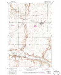
The Northern Pacific railroad corridor anchors this mid-century portrait of North Dakota prairie life, centering on the hub of Maddock. The landscape is defined by the deep carving of the Sheyenne River across the southern sections and the prominent Big Coulee running north-to-south, which together dictate the regional drainage and agricultural patterns. This survey reflects a well-established rural social structure, evidenced by the distribution of country schools like Arne Sch and Quarve Sch and spiritual centers such as Fron Ch. The township divisions—North Viking, Arne, and South Viking—provide a clear framework for genealogists tracking family land holdings. Small-scale industrial activity is also visible near the rail line through local operations like the Gravel Pit, supporting the infrastructure of this Benson County community.
Find a feature on this map
15 named features on this map. Tap any name to fly to it.
Don’t see what you’re looking for? This feature index may not catch every label — zoom into the map to look around manually.
Map Details
Editions of this 1951 Maddock Map
2 editions found
Other maps of this area

1932 · Flora
USGS Topo · 1:62,500

1943 · Maddock
USGS Topo · 1:62,500

1945 · Maddock
USGS Topo · 1:62,500

1951 · Black Hammer Hill
USGS Topo · 1:24,000

1951 · Flora
USGS Topo · 1:24,000
1951 · Heimdal
USGS Topo · 1:24,000

1951 · Hesper
USGS Topo · 1:24,000
1951 · Hamberg
USGS Topo · 1:24,000

1951 · Flora
USGS Topo · 1:62,500

1952 · New Rockford
USGS Topo · 1:250,000