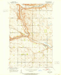
1951 Map of Heimdal
USGS Topo · Published 1953About this map
Heimdal sits as a vital rail hub along the Great Northern tracks in Wells County, serving a landscape defined by the winding valley of the Sheyenne River. This mid-century survey illustrates a prairie economy shaped by early 20th-century township divisions, including Arne, Fram, and West Norway. The river's north fork carves a significant corridor through the northern sections, while the south is marked by the expansive Big Slough.
Find a feature on this map
20 named features on this map. Tap any name to fly to it.
Don’t see what you’re looking for? This feature index may not catch every label — zoom into the map to look around manually.
Map Details
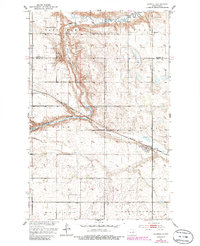
Editions of this 1951 Heimdal Map
2 editions found
Other maps of this area

1941 · Selz
USGS Topo · 1:62,500

1943 · Maddock
USGS Topo · 1:62,500

1945 · Maddock
USGS Topo · 1:62,500

1945 · Manfred
USGS Topo · 1:62,500

1948 · Fessenden
USGS Topo · 1:62,500

1948 · Manfred
USGS Topo · 1:62,500

1949 · Fessenden East
USGS Topo · 1:24,000

1949 · Fessenden West
USGS Topo · 1:24,000

1950 · Wellsburg
USGS Topo · 1:24,000

1950 · Manfred
USGS Topo · 1:24,000