
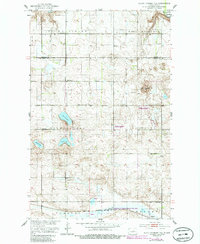
1951 Map of Black Hammer Hill
USGS Topo · Published 1953About this map
Bremen lies at the southern edge of this North Dakota landscape, situated along the Great Northern rail line and the edge of Big Slough. This mid-century survey reveals a rural prairie community defined by its township boundaries and township schools, including School No 1, School No 2, and School No 3. These social hubs are joined by civic and religious landmarks such as the Town Hall, Viking Ch, and Trinity Cem near the rail line.
Find a feature on this map
22 named features on this map. Tap any name to fly to it.
Don’t see what you’re looking for? This feature index may not catch every label — zoom into the map to look around manually.
Map Details
Editions of this 1951 Black Hammer Hill Map
2 editions found
Other maps of this area

1932 · Flora
USGS Topo · 1:62,500

1943 · Maddock
USGS Topo · 1:62,500

1945 · Maddock
USGS Topo · 1:62,500

1948 · Cathay
USGS Topo · 1:62,500

1948 · Fessenden
USGS Topo · 1:62,500

1948 · Bremen
USGS Topo · 1:24,000

1949 · Bremen
USGS Topo · 1:24,000

1949 · Fessenden East
USGS Topo · 1:24,000

1949 · Munster
USGS Topo · 1:24,000

1951 · Flora SE
USGS Topo · 1:24,000