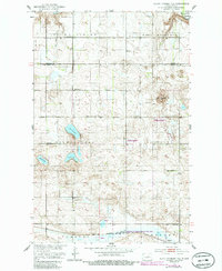
1951 Map of Black Hammer Hill
USGS Topo · Published 1986About this map
The Sheyenne River winds through the northeast corner of this Wells and Benson County landscape, which is characterized by a high density of small water bodies and seasonal wetlands. Rural life in the mid-20th century centered on township hubs and small-scale infrastructure, evidenced by the distribution of School No 1, School No 2, and School No 3 across the prairie. The settlement of Bremen sits in the southeast corner along the Burlington Northern railroad, serving as a transit point near the marshy expanse of Big Slough. Local heritage is anchored by sites like Viking Church and Unity Cemetery in the northern townships. The area is also notable for the National Waterfowl Production Area, which protects the habitat surrounding Norway Lake, Goose Lake, and Zumpt Lake. The namesake Black Hammer Hill provides a distinct topographical landmark in an otherwise subtly rolling prairie environment.
Find a feature on this map
22 named features on this map. Tap any name to fly to it.
Don’t see what you’re looking for? This feature index may not catch every label — zoom into the map to look around manually.
Map Details
Editions of this 1951 Black Hammer Hill Map
2 editions found

Other maps of this area

1932 · Flora
USGS Topo · 1:62,500

1943 · Maddock
USGS Topo · 1:62,500

1945 · Maddock
USGS Topo · 1:62,500

1948 · Cathay
USGS Topo · 1:62,500

1948 · Fessenden
USGS Topo · 1:62,500

1948 · Bremen
USGS Topo · 1:24,000

1949 · Bremen
USGS Topo · 1:24,000

1949 · Fessenden East
USGS Topo · 1:24,000

1949 · Munster
USGS Topo · 1:24,000

1951 · Flora SE
USGS Topo · 1:24,000