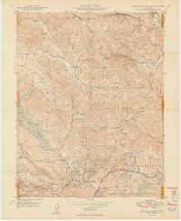
1949 Map of Briones Valley
USGS Topo · Published 1949About this map
San Pablo Reservoir and the surrounding ridgelines dominate this late-1940s landscape, illustrating the critical water infrastructure serving the growing East Bay. The map captures the transition from the pastoral cattle lands of La Boca De La Cañada Del Pinole and Briones Valley to the early residential development near Orinda Village. To the south, the borders of Tilden Regional Park meet the high points of Grizzly Pk and Bald Pk on the Alameda County line. Infrastructure like the Mokelumne Aqueduct and the Atohison Topeka and Santa Fe railroad through Franklin Canyon reveal the complex logistical networks of the era. Smaller local landmarks such as the Briones Valley Sch and the Filtration Plant near Lafayette Reservoir provide specific points of interest for local history researchers and genealogists tracing family footprints in Contra Costa County.
Find a feature on this map
45 named features on this map. Tap any name to fly to it.
Don’t see what you’re looking for? This feature index may not catch every label — zoom into the map to look around manually.
Map Details
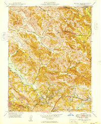
Editions of this 1949 Briones Valley Map
2 editions found
Other maps of this area

1895 · San Francisco
USGS Topo · 1:62,500

1896 · Carquinez Strait
USGS Topo · 1:62,500

1897 · Concord
USGS Topo · 1:62,500

1898 · Karquines
USGS Topo · 1:62,500

1899 · San Francisco
USGS Topo · 1:62,500

1901 · Karquines
USGS Topo · 1:62,500

1902 · Napa
USGS Topo · 1:125,000

1915 · Concord
USGS Topo · 1:62,500

1915 · San Francisco
USGS Topo · 1:62,500

1916 · Mare Island
USGS Topo · 1:62,500