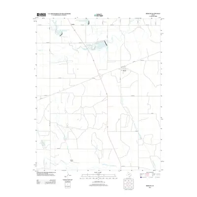
2012 Map of Briscoe
USGS Topo · Published 2012About this map
The small communities of Briscoe and Gageby anchor this portion of the Texas Panhandle, where the landscape is defined by a series of water management projects and seasonal drainages. Modern infrastructure is evident in the presence of Soil Conservation Service Site 20 Reservoir and Soil Conservation Service Site 22 Reservoir, alongside Lake Fensterwald and Valley Springs Lakes. The map reveals a highly structured grid of rural county roads, such as Co Road A and Co Road D, which facilitate movement between these remote settlements and their agricultural lands. The drainage network is particularly detailed, showing the courses of Gageby Cr, Jenkins-Jones Cr, and Sweetwater Cr. The inclusion of Osburn Draw provides insight into the local topography, marking a distinct natural channel that contrasts with the surrounding engineered reservoirs.
Find a feature on this map
32 named features on this map. Tap any name to fly to it.
Don’t see what you’re looking for? This feature index may not catch every label — zoom into the map to look around manually.
Map Details
Editions of this 2012 Briscoe Map
This is the sole edition of this map. No revisions or reprints were ever made.
Other maps of this area

1954 · Amarillo
USGS Topo · 1:250,000

1958 · Amarillo
USGS Topo · 1:250,000

1962 · Wheeler
USGS Topo · 1:24,000

1962 · Spring Creek
USGS Topo · 1:24,000

1963 · Kelton NW
USGS Topo · 1:24,000

1963 · Briscoe
USGS Topo · 1:24,000

1963 · Allison SW
USGS Topo · 1:24,000

1963 · Mobeetie
USGS Topo · 1:24,000

1967 · Dads Creek
USGS Topo · 1:24,000

1967 · Lake June
USGS Topo · 1:24,000