
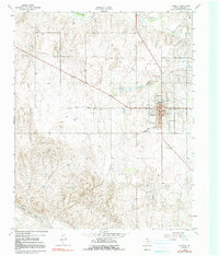
1962 Map of Wheeler
USGS Topo · Published 1965About this map
Wheeler serves as the focal point of this Panhandle landscape, where the town grid is defined by a central Courthouse and Po. The surrounding terrain transitions from the relatively flat ranchland in the north, drained by Sweetwater Creek and Jenkins-Jones Creek, into the broken breaks and canyons carved by the North Fork Red River in the southwest.
Find a feature on this map
12 named features on this map. Tap any name to fly to it.
Don’t see what you’re looking for? This feature index may not catch every label — zoom into the map to look around manually.
Map Details
Editions of this 1962 Wheeler Map
2 editions found
Other maps of this area

1954 · Amarillo
USGS Topo · 1:250,000

1958 · Amarillo
USGS Topo · 1:250,000

1962 · Twitty
USGS Topo · 1:24,000

1962 · Spring Creek
USGS Topo · 1:24,000

1962 · Wheeler SE
USGS Topo · 1:24,000

1962 · Pakan
USGS Topo · 1:24,000

1963 · Kelton NW
USGS Topo · 1:24,000

1963 · Briscoe
USGS Topo · 1:24,000

1963 · Allison SW
USGS Topo · 1:24,000

1963 · Mobeetie
USGS Topo · 1:24,000