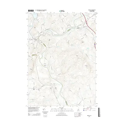
2015 Map of Bristol
USGS Topo · Published 2015About this map
The Pemigewasset River and the Smith River converge near the town of Bristol, shaping a landscape of deep valleys and prominent peaks. This 2015 survey shows the settlement patterns across the borders of Grafton, Belknap, and Merrimack counties. Along the southern reaches, Hill Center and Hill provide a glimpse into the rural community structure, anchored by the Hill Center Church and several burial grounds including Bunker Hill Cem and Pleasant Hill Cem. The terrain is dominated by a series of significant elevations such as Burleigh Mtn, Hersey Mtn, and Sanbornton Mtn, which overlook numerous small waterways like Prescott Brook and Needle Shop Brook. The presence of the Newfound River Reservoir and Newfound Lake in the northwest highlights the importance of water management and recreation in this part of New Hampshire.
Find a feature on this map
112 named features on this map. Tap any name to fly to it.
Don’t see what you’re looking for? This feature index may not catch every label — zoom into the map to look around manually.
Map Details
Editions of this 2015 Bristol Map
This is the sole edition of this map. No revisions or reprints were ever made.
Other maps of this area

1925 · Holderness
USGS Topo · 1:62,500

1927 · Penacook
USGS Topo · 1:62,500

1927 · Holderness
USGS Topo · 1:62,500

1927 · Cardigan
USGS Topo · 1:62,500

1928 · Mount Kearsarge
USGS Topo · 1:62,500

1930 · Cardigan
USGS Topo · 1:62,500

1931 · Mount Kearsarge
USGS Topo · 1:62,500

1949 · Portland
USGS Topo · 1:250,000

1956 · Cardigan
USGS Topo · 1:62,500

1956 · Penacook
USGS Topo · 1:62,500