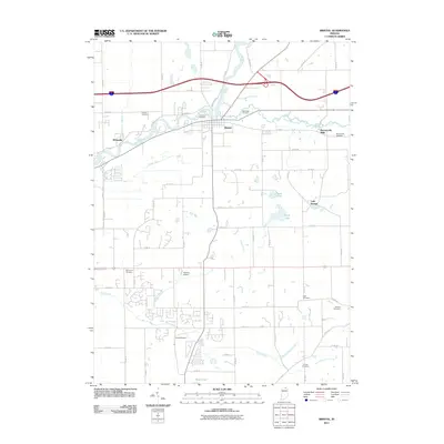
2011 Map of Bristol
USGS Topo · Published 2011About this map
The Saint Joseph River and the Little Elkhart River converge at Bristol in this northern Indiana landscape, where water has long shaped the pattern of settlement. At Bonneyville Mills, the persistence of local industry is recorded alongside the nearby Bonneyville Cemetery, while other historic family burial grounds like Proctor Cemetery, Cathcart Cemetery, and Oak Ridge Cemetery dot the riverbanks. The township structure is visible through a grid of county roads, punctuated by small aviation sites like Hatfield Airport and Kropf Airport. The map also captures the agricultural drainage systems vital to the region, including Menges Ditch and the Washington Township Ditch, illustrating how the land south of Nibbyville has been managed for farming and local commerce.
Find a feature on this map
49 named features on this map. Tap any name to fly to it.
Don’t see what you’re looking for? This feature index may not catch every label — zoom into the map to look around manually.
Map Details
Editions of this 2011 Bristol Map
This is the sole edition of this map. No revisions or reprints were ever made.
Other maps of this area

1914 · Three Rivers
USGS Topo · 1:62,500

1916 · Three Rivers
USGS Topo · 1:62,500

1943 · Three Rivers
USGS Topo · 1:62,500

1948 · Vandalia
USGS Topo · 1:62,500

1949 · Vandalia
USGS Topo · 1:62,500

1953 · Fort Wayne
USGS Topo · 1:250,000

1956 · Fort Wayne
USGS Topo · 1:250,000

1959 · Millersburg
USGS Topo · 1:24,000

1959 · Goshen
USGS Topo · 1:24,000

1960 · Foraker
USGS Topo · 1:24,000