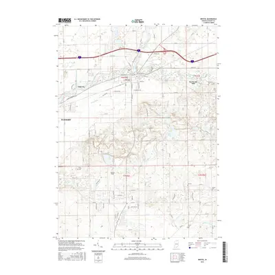
2016 Map of Bristol
USGS Topo · Published 2016About this map
The Saint Joseph River and Little Elkhart River converge near the town of Bristol, anchoring a landscape defined by its river-bend settlements and agricultural history. This survey illustrates the proximity of several distinct communities, including the milling center at Bonneyville Mills and the residential pocket of Nibbyville. Genealogists will find a high concentration of burial grounds throughout the countryside, such as Cathcart Cem, Oak Ridge Cem, and Proctor Cem, which trace the legacy of early families in Washington Township. The terrain is marked by a network of drainage features like Menges Ditch and Hildreth Ditch, while Hatfield Airport provides a modern aviation landmark amidst the rural sections. To the west, the expansion of Elkhart begins to interface with the more traditional rural layout, highlighting the suburban evolution occurring south of the Michigan border.
Find a feature on this map
85 named features on this map. Tap any name to fly to it.
Don’t see what you’re looking for? This feature index may not catch every label — zoom into the map to look around manually.
Map Details
Editions of this 2016 Bristol Map
This is the sole edition of this map. No revisions or reprints were ever made.
Other maps of this area

1914 · Three Rivers
USGS Topo · 1:62,500

1916 · Three Rivers
USGS Topo · 1:62,500

1943 · Three Rivers
USGS Topo · 1:62,500

1948 · Vandalia
USGS Topo · 1:62,500

1949 · Vandalia
USGS Topo · 1:62,500

1953 · Fort Wayne
USGS Topo · 1:250,000

1956 · Fort Wayne
USGS Topo · 1:250,000

1959 · Millersburg
USGS Topo · 1:24,000

1959 · Goshen
USGS Topo · 1:24,000

1960 · Foraker
USGS Topo · 1:24,000