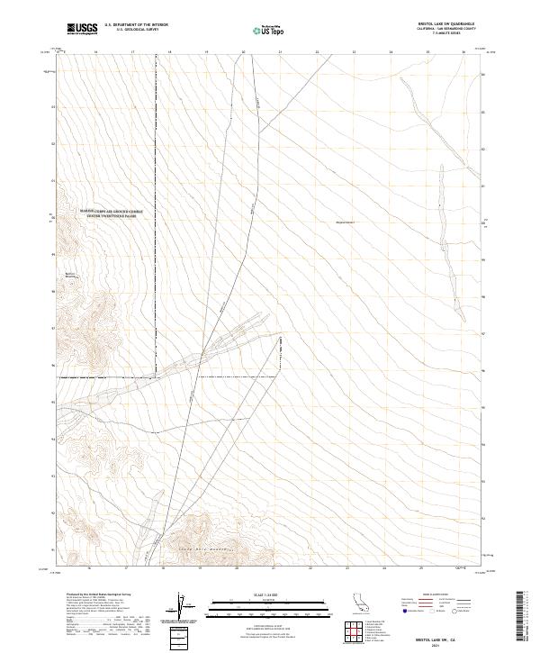
2021 Map of Bristol Lake SW
USGS Topo · Published 2021About this map
The Mojave Desert terrain dominates this corner of San Bernardino County, where dramatic elevation changes define the transition between several prominent landforms. To the west, the Bullion Mountains rise sharply, while the southern boundary is marked by the Sheep Hole Mountains. This arid expanse is bisected by the diagonal corridor of Amboy Rd and S Amboy Rd, which serves as the primary artery through an otherwise sparse landscape. The map illustrates a classic desert basin-and-range configuration, showing how drainage patterns from the surrounding peaks flow toward the lower elevations. It is a study in isolation and natural boundaries, capturing a rugged section of Southern California where infrastructure remains minimal compared to the sweeping mountain ranges.
Find a feature on this map
9 named features on this map. Tap any name to fly to it.
Don’t see what you’re looking for? This feature index may not catch every label — zoom into the map to look around manually.
Map Details
Editions of this 2021 Bristol Lake SW Map
This is the sole edition of this map. No revisions or reprints were ever made.
Other maps of this area

1942 · Amboy
USGS Topo · 1:250,000

1943 · Amboy
USGS Topo · 1:250,000

1954 · Needles
USGS Topo · 1:250,000

1954 · Bristol Lake NW
USGS Topo · 1:24,000

1954 · Bristol Lake SW
USGS Topo · 1:24,000

1955 · Lead Mtn. NE
USGS Topo · 1:24,000
1955 · Cleghorn Lakes
USGS Topo · 1:24,000

1955 · Lead Mountain
USGS Topo · 1:62,500

1956 · Needles
USGS Topo · 1:250,000

1956 · Dale Lake
USGS Topo · 1:62,500