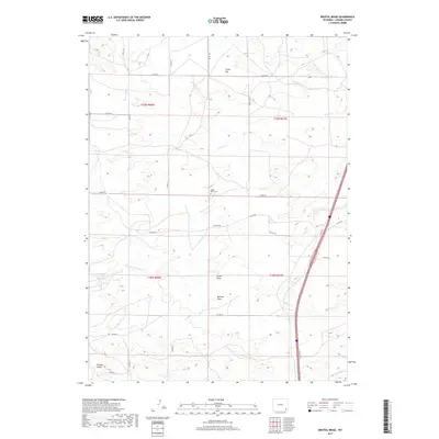
2017 Map of Bristol Ridge
USGS Topo · Published 2017About this map
Little Bear Cem sits near the center of this Laramie County landscape, a marker of early ranching families in a territory defined by expansive draws and intermittent watercourses. The terrain is characterized by prominent landforms such as Chalk Hill to the north and the namesake Bristol Ridge in the southwest corner. The hydrologic network is anchored by N Bear Cr and the Nimmo Reservoir Number 9, supporting the grazing operations that have long shaped this part of Wyoming. A network of county roads, including Dayton Rd and True Rd, connects the scattered ranch holdings across Sweet Draw and McCann Draw, reflecting a rural infrastructure designed around the livestock economy and the natural flow of the High Plains drainage systems.
Find a feature on this map
28 named features on this map. Tap any name to fly to it.
Don’t see what you’re looking for? This feature index may not catch every label — zoom into the map to look around manually.
Map Details
Editions of this 2017 Bristol Ridge Map
This is the sole edition of this map. No revisions or reprints were ever made.
Other maps of this area

1905 · Sherman
USGS Topo · 1:125,000

1911 · Cheyenne
USGS Topo · 1:125,000

1914 · Cheyenne
USGS Topo · 1:125,000

1954 · Cheyenne
USGS Topo · 1:250,000

1958 · Cheyenne
USGS Topo · 1:250,000

1962 · Dereemer Ranch
USGS Topo · 1:24,000

1962 · Moffett Ranch
USGS Topo · 1:24,000

1962 · Lewis Ranch
USGS Topo · 1:24,000

1962 · Bristol Ridge
USGS Topo · 1:24,000

1962 · Hirsig Ranch
USGS Topo · 1:24,000