
1962 Map of Bristol Ridge
USGS Topo · Published 1964About this map
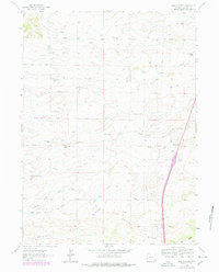
The drainage system of the North Bear Creek and its southern forks dominates this high plains landscape in Laramie County. Ranching life is the primary focus of this 1962 field-checked study, which identifies numerous family-named homesteads including the Harry Dayton Ranch, Custer Ranch, and Hoyt Duvall Ranch scattered across the undulating terrain. These settlements follow the water sources and the path of the Bristol Ridge Road, illustrating the sparse but deliberate distribution of 20th-century Wyoming livestock operations. Notable landmarks such as the Bliss Pumping Sta and a prominent Pipeline cutting through the eastern sections reflect the industrial infrastructure supporting the region. The map also records the Little Bear Cem, a vital site for genealogical research, located near the southern boundary where the landscape begins to climb toward the eponymous Bristol Ridge.
Find a feature on this map
26 named features on this map. Tap any name to fly to it.
Don’t see what you’re looking for? This feature index may not catch every label — zoom into the map to look around manually.
Map Details
Editions of this 1962 Bristol Ridge Map
2 editions found
Other maps of this area

1905 · Sherman
USGS Topo · 1:125,000

1911 · Cheyenne
USGS Topo · 1:125,000

1914 · Cheyenne
USGS Topo · 1:125,000

1954 · Cheyenne
USGS Topo · 1:250,000

1958 · Cheyenne
USGS Topo · 1:250,000

1962 · Dereemer Ranch
USGS Topo · 1:24,000

1962 · Moffett Ranch
USGS Topo · 1:24,000

1962 · Lewis Ranch
USGS Topo · 1:24,000

1962 · Hirsig Ranch
USGS Topo · 1:24,000

1962 · Mc Donald Ranch
USGS Topo · 1:24,000