
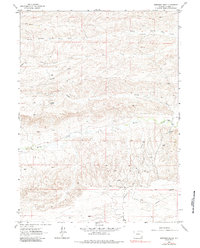
1962 Map of Dereemer Ranch
USGS Topo · Published 1964About this map
Dereemer Ranch and Whitaker Ranch anchor this 1962 field-checked study of the Laramie high plains. The landscape is defined by the winding course of Horse Creek and the branching drainage systems of North Branch Little Bear Creek and South Fork Little Bear Creek. These watercourses provided the essential lifeblood for early ranching operations in this part of Wyoming, where the terrain is further segmented by numerous ephemeral features like Gundby Draw and Sheppard Draw.
Find a feature on this map
11 named features on this map. Tap any name to fly to it.
Don’t see what you’re looking for? This feature index may not catch every label — zoom into the map to look around manually.
Map Details
Editions of this 1962 Dereemer Ranch Map
2 editions found
Other maps of this area

1905 · Sherman
USGS Topo · 1:125,000

1911 · Cheyenne
USGS Topo · 1:125,000

1914 · Cheyenne
USGS Topo · 1:125,000

1954 · Cheyenne
USGS Topo · 1:250,000

1958 · Cheyenne
USGS Topo · 1:250,000

1962 · Horse Creek
USGS Topo · 1:24,000

1962 · Federal
USGS Topo · 1:24,000

1962 · Farthing
USGS Topo · 1:24,000
1962 · Farthing Ranch
USGS Topo · 1:24,000

1962 · Bristol Ridge
USGS Topo · 1:24,000