
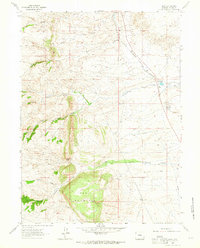
1962 Map of Horse Creek
USGS Topo · Published 1964About this map
Industrial quarrying and ranching define this high-plains landscape in Laramie County during the early 1960s. The Colorado and Southern railroad serves as the primary artery for the region, supporting the Horse Creek Siding and providing transit for the nearby Horse Creek Quarries. This industrial presence is concentrated along the dramatic western ridge known as the Hogback, which rises sharply above the drainage of Horse Creek.
Find a feature on this map
38 named features on this map. Tap any name to fly to it.
Don’t see what you’re looking for? This feature index may not catch every label — zoom into the map to look around manually.
Map Details
Editions of this 1962 Horse Creek Map
This is the sole edition of this map. No revisions or reprints were ever made.
Other maps of this area

1905 · Sherman
USGS Topo · 1:125,000

1948 · Ragged Top Mountain
USGS Topo · 1:62,500

1950 · Ragged Top Mountain
USGS Topo · 1:62,500

1954 · Cheyenne
USGS Topo · 1:250,000

1955 · Goat Mountain
USGS Topo · 1:24,000

1958 · Cheyenne
USGS Topo · 1:250,000

1962 · Federal
USGS Topo · 1:24,000

1962 · Dereemer Ranch
USGS Topo · 1:24,000

1962 · Farthing
USGS Topo · 1:24,000
1962 · Islay
USGS Topo · 1:24,000