
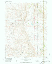
1955 Map of Goat Mountain
USGS Topo · Published 1957About this map
Iron Mountain and the prominent Limestone Rim dominate this high-plains landscape in the mid-1950s. The area is defined by a ranching and mining economy, where the network of Chugwater Creek tributaries, such as Middle Chugwater Creek and South Chugwater Creek, provides essential water for established operations like the Bell Ranch and Indian Guide Ranch. The presence of Titaniferous Deposits and a Titaniferous Prospect Area near Goat Mountain highlights the mineral exploration of the era. This survey, part of the Missouri River Basin development program, captures the intersection of the Albany and Laramie county lines amidst a landscape of named high-country flats, including Coyote Flat and Long Flat. Local history is anchored at sites such as Iron Mountain Camp and the uniquely named Dummy Hill.
Find a feature on this map
23 named features on this map. Tap any name to fly to it.
Don’t see what you’re looking for? This feature index may not catch every label — zoom into the map to look around manually.
Map Details
Editions of this 1955 Goat Mountain Map
3 editions found
Other maps of this area

1905 · Sherman
USGS Topo · 1:125,000

1948 · Ragged Top Mountain
USGS Topo · 1:62,500

1950 · Ragged Top Mountain
USGS Topo · 1:62,500

1954 · Cheyenne
USGS Topo · 1:250,000

1955 · Indian Guide
USGS Topo · 1:24,000

1955 · Baldy Mountain
USGS Topo · 1:24,000

1955 · Sheep Rock
USGS Topo · 1:24,000

1958 · Cheyenne
USGS Topo · 1:250,000

1962 · Horse Creek
USGS Topo · 1:24,000

1962 · Farthing
USGS Topo · 1:24,000