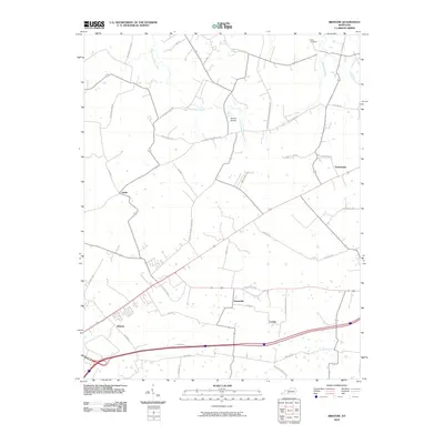
2010 Map of Bristow
USGS Topo · Published 2010About this map
Bristow and its surrounding rural corridors in Warren County are characterized by a network of local roads and creek drainages that have defined this landscape for generations. The settlement of Sunnyside and the nearby Loving community sit at the intersection of various family-named routes, including Fred Madison Rd and Goshen Church Rd N. In the northern section, the terrain is shaped by the winding path of Little Beaverdam Creek and the notable Boiling Spring, which once served as vital water sources for local farmsteads. Smaller communities like Girkin and Tuckertown remain anchored by historical roads such as Tuckertown Rd and Girkin Rd. Genealogists may find particular interest in the Long Cemetery, situated near the headwaters of Alexander Creek, which provides a focal point for tracing early family lineages in this part of Kentucky.
Find a feature on this map
39 named features on this map. Tap any name to fly to it.
Don’t see what you’re looking for? This feature index may not catch every label — zoom into the map to look around manually.
Map Details
Editions of this 2010 Bristow Map
This is the sole edition of this map. No revisions or reprints were ever made.
Other maps of this area

1921 · Bowling Green
USGS Topo · 1:62,500

1922 · Brownsville
USGS Topo · 1:62,500

1922 · Mammoth Cave
USGS Topo · 1:62,500

1923 · Bowling Green
USGS Topo · 1:62,500

1923 · Mammoth Cave
USGS Topo · 1:62,500

1923 · Brownsville
USGS Topo · 1:62,500

1926 · Scottsville
USGS Topo · 1:62,500

1954 · Evansville
USGS Topo · 1:250,000

1954 · Bowling Green North
USGS Topo · 1:24,000

1954 · Bristow
USGS Topo · 1:24,000