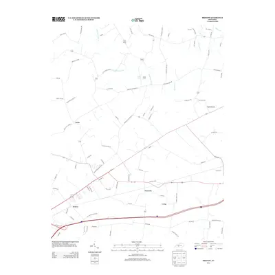
2013 Map of Bristow
USGS Topo · Published 2013About this map
Bristow and Sunnyside anchor this landscape just northeast of Bowling Green, where early 21st-century rural development meets the traditional agricultural character of Warren County. The map reveals a dense network of country roads named for local families and landmarks, such as Roger Cole Rd, Ellis Cole Rd, and Noah Bledsoe Rd, which reflect the area's genealogical roots. Notable water features like Boiling Spring and Little Beaverdam Cr drainage patterns dictate the placement of these historic settlements.
Find a feature on this map
77 named features on this map. Tap any name to fly to it.
Don’t see what you’re looking for? This feature index may not catch every label — zoom into the map to look around manually.
Map Details
Editions of this 2013 Bristow Map
This is the sole edition of this map. No revisions or reprints were ever made.
Other maps of this area

1921 · Bowling Green
USGS Topo · 1:62,500

1922 · Brownsville
USGS Topo · 1:62,500

1922 · Mammoth Cave
USGS Topo · 1:62,500

1923 · Bowling Green
USGS Topo · 1:62,500

1923 · Mammoth Cave
USGS Topo · 1:62,500

1923 · Brownsville
USGS Topo · 1:62,500

1926 · Scottsville
USGS Topo · 1:62,500

1954 · Evansville
USGS Topo · 1:250,000

1954 · Bowling Green North
USGS Topo · 1:24,000

1954 · Bristow
USGS Topo · 1:24,000