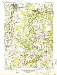
1944 Map of Broad Brook
USGS Topo · Published 1944About this map
The Connecticut River forms the western boundary of this 1944 survey, where the New York New Haven and Hartford Railroad follows the bank north through Warehouse Point toward Thompsonville. This period of wartime development is reflected in the dense settlement patterns around industrial hubs like Hazardville and the milling operations at Sadda Mill. The landscape is defined by the meandering Scantic River and its numerous tributaries, including Buckhorn Brook and Ketch Brook, which supported the early agricultural and manufacturing growth of Enfield and East Windsor. Genealogists will find a significant concentration of burial grounds, such as St Patricks Cem and King St Cem, alongside local institutions like the County Home and several rural schoolhouses, including the Wallop Sch.
Find a feature on this map
50 named features on this map. Tap any name to fly to it.
Don’t see what you’re looking for? This feature index may not catch every label — zoom into the map to look around manually.
Map Details
Editions of this 1944 Broad Brook Map
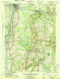
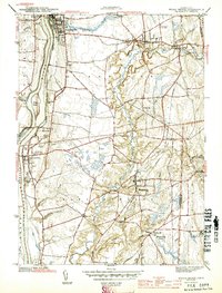
3 editions found
Other maps of this area

1886 · Springfield
USGS Topo · 1:62,500

1887 · Palmer
USGS Topo · 1:62,500

1889 · Springfield
USGS Topo · 1:62,500

1889 · Palmer
USGS Topo · 1:62,500

1892 · Hartford
USGS Topo · 1:62,500

1892 · Tolland
USGS Topo · 1:62,500

1893 · Springfield
USGS Topo · 1:62,500

1893 · Palmer
USGS Topo · 1:62,500

1895 · Springfield
USGS Topo · 1:62,500

1896 · Holyoke
USGS Topo · 1:125,000