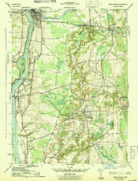
1944 Map of Broad Brook
USGS Topo · Published 1944About this map
Thompsonville and Enfield anchor the northern landscape of this 1944 War Department survey, where the Connecticut River serves as the primary geographic corridor. The era’s industrial and transit backbone is clearly traced by the New York New Haven and Hartford Railroad, which parallels the riverbank and connects Riverside hamlets like Warehouse Point. This sheet reveals the dense network of rural infrastructure in the Hartford County interior, specifically within East Windsor.
Find a feature on this map
46 named features on this map. Tap any name to fly to it.
Don’t see what you’re looking for? This feature index may not catch every label — zoom into the map to look around manually.
Map Details
Editions of this 1944 Broad Brook Map
3 editions found
Other maps of this area

1886 · Springfield
USGS Topo · 1:62,500

1887 · Palmer
USGS Topo · 1:62,500

1889 · Springfield
USGS Topo · 1:62,500

1889 · Palmer
USGS Topo · 1:62,500

1892 · Hartford
USGS Topo · 1:62,500

1892 · Tolland
USGS Topo · 1:62,500

1893 · Springfield
USGS Topo · 1:62,500

1893 · Palmer
USGS Topo · 1:62,500

1895 · Springfield
USGS Topo · 1:62,500

1896 · Holyoke
USGS Topo · 1:125,000