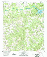
1955 Map of Broad
USGS Topo · Published 1986About this map
Anthony Shoals marks a significant natural bottleneck on the Broad River as it winds through Wilkes, Elbert, and Lincoln counties. This mid-1950s landscape is defined by the encroaching Clark Hill Reservoir, which has altered the traditional riverbank geography and established the Clark Hill Reservation Boundary. The map reveals a dense network of rural community centers, particularly a high concentration of country churches that served the agricultural population, such as Popes Chapel, Shiloh Ch, and Newford Ch. The Nancy Hart Highway runs through the northwest corner near Nancy Hart Park, while smaller settlements like Delhi and Broad remain connected by unimproved roads. Notable social landmarks like Pole Branch Sch and Cade Chapel provide specific points of interest for genealogists tracing family histories in this part of Georgia during the mid-twentieth century.
Find a feature on this map
32 named features on this map. Tap any name to fly to it.
Don’t see what you’re looking for? This feature index may not catch every label — zoom into the map to look around manually.
Map Details
Editions of this 1955 Broad Map
2 editions found
Other maps of this area

1893 · Elberton
USGS Topo · 1:125,000

1906 · Crawfordville
USGS Topo · 1:125,000

1953 · Athens
USGS Topo · 1:250,000

1954 · Metasville
USGS Topo · 1:24,000

1954 · Greenville
USGS Topo · 1:250,000

1955 · Tignall
USGS Topo · 1:24,000

1955 · Broad
USGS Topo · 1:24,000

1955 · Chennault
USGS Topo · 1:24,000

1958 · Greenville
USGS Topo · 1:250,000

1958 · Athens
USGS Topo · 1:250,000