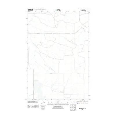
2011 Map of Broadview NE
USGS Topo · Published 2011About this map
Spring Creek meanders across this rural expanse of Yellowstone County, defining the drainage patterns in a landscape marked by straight-line section roads and intermittent waterways. During this period in the early 21st century, the area maintained a sparse, agricultural character, with long stretches of naming-convention roads such as Buffalo Hwy and Boxcar Rd providing the primary transit network. In the northern reaches, Painted Robe Creek flows through the terrain, while the southern border is marked by the presence of Sand Creek. The map reveals a highly structured grid of land management, where local thoroughfares like Homestead Rd and Coyote Creek RD connect isolated ranching or farming plots. This survey provides a clear view of the water-dependent topography in a region where named creeks like these are the primary geographical anchors.
Find a feature on this map
13 named features on this map. Tap any name to fly to it.
Don’t see what you’re looking for? This feature index may not catch every label — zoom into the map to look around manually.
Map Details
Editions of this 2011 Broadview NE Map
This is the sole edition of this map. No revisions or reprints were ever made.
Other maps of this area

1954 · Roundup
USGS Topo · 1:250,000

1958 · Roundup
USGS Topo · 1:250,000

1979 · Roundup
USGS Topo · 1:100,000

1979 · Bundy
USGS Topo · 1:24,000

1979 · Lavina
USGS Topo · 1:24,000

1979 · Belmont
USGS Topo · 1:24,000

1979 · Elso
USGS Topo · 1:24,000
1979 · Broadview East
USGS Topo · 1:24,000
1980 · Broadview West
USGS Topo · 1:24,000
1980 · Broadview NE
USGS Topo · 1:24,000