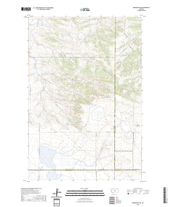
2024 Map of Broadview NE
USGS Topo · Published 2024About this map
Golden Valley County Waterfowl Production Area dominates the southwestern corner of this modern topographic survey, highlighting the critical role of conservation within this high-plains landscape. The terrain transitions from the open drainage basins of Painted Robe Creek and Spring Creek in the north toward the rising elevations of the Bull Mountains in the east. This area, where Golden Valley Co, Musselshell Co, and Yellowstone Co meet, is defined by a sparse but deliberate network of local routes such as Boxcar Rd and Swartz Nelson Rd. The presence of Cemetery Rd near the southern boundary suggests local family roots and historical burial sites established near the seasonal flow of Sand Creek. The map effectively illustrates the intersection of public land management and private ranching interests at the contemporary tri-county border.
Find a feature on this map
27 named features on this map. Tap any name to fly to it.
Don’t see what you’re looking for? This feature index may not catch every label — zoom into the map to look around manually.
Map Details
Editions of this 2024 Broadview NE Map
This is the sole edition of this map. No revisions or reprints were ever made.
Other maps of this area

1954 · Roundup
USGS Topo · 1:250,000

1958 · Roundup
USGS Topo · 1:250,000

1979 · Roundup
USGS Topo · 1:100,000

1979 · Bundy
USGS Topo · 1:24,000

1979 · Lavina
USGS Topo · 1:24,000

1979 · Belmont
USGS Topo · 1:24,000

1979 · Elso
USGS Topo · 1:24,000
1979 · Broadview East
USGS Topo · 1:24,000
1980 · Broadview West
USGS Topo · 1:24,000
1980 · Broadview NE
USGS Topo · 1:24,000