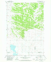
1980 Map of Broadview NE
USGS Topo · Published 1980About this map
The rolling grasslands of south-central Montana are defined here by the meeting of three counties—Golden Valley, Musselshell, and Yellowstone. The landscape is primarily shaped by the meandering courses of Painted Robe Creek and Spring Creek, which cut through the northern and western sections of the terrain. This 1980 edition illustrates a predominantly rural and utilitarian landscape, where modern infrastructure begins to leave its mark on the open country. A prominent Pipeline traverses the western hills, while scattered infrastructure like a Gravel Pit and several drill holes indicate localized industrial activity or resource exploration. The map serves as a detailed record of land use and drainage patterns in this high plains region during the late twentieth century.
Find a feature on this map
8 named features on this map. Tap any name to fly to it.
Don’t see what you’re looking for? This feature index may not catch every label — zoom into the map to look around manually.
Map Details
Editions of this 1980 Broadview NE Map
This is the sole edition of this map. No revisions or reprints were ever made.
Other maps of this area

1954 · Roundup
USGS Topo · 1:250,000

1958 · Roundup
USGS Topo · 1:250,000

1979 · Roundup
USGS Topo · 1:100,000

1979 · Bundy
USGS Topo · 1:24,000

1979 · Lavina
USGS Topo · 1:24,000

1979 · Belmont
USGS Topo · 1:24,000

1979 · Elso
USGS Topo · 1:24,000
1979 · Broadview East
USGS Topo · 1:24,000
1980 · Broadview West
USGS Topo · 1:24,000
1980 · Hay Basin North
USGS Topo · 1:24,000