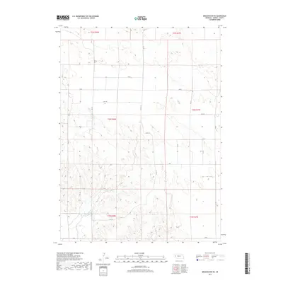
2017 Map of Broadwater NE
USGS Topo · Published 2017About this map
Lower Dugout Creek and its tributary branches define the drainage patterns of this Morrill County landscape. The area is structured by a network of rural routes and sectional boundaries, including Alliance Rd and various county roads such as Co Rd 100 and Co Rd 96. The terrain is characterized by the complex contour lines of the Nebraska panhandle, showing the natural erosion patterns and land elevation changes typical of the region. This survey captures the land as it was organized for ranching or agricultural use in the early 21st century, revealing how modern infrastructure like Rd 133 and Rd 125 follows the established Public Land Survey System grid. The map serves as a clear record of the watershed and road network near the western edge of the Nebraska Sandhills transition.
Find a feature on this map
24 named features on this map. Tap any name to fly to it.
Don’t see what you’re looking for? This feature index may not catch every label — zoom into the map to look around manually.
Map Details
Editions of this 2017 Broadwater NE Map
This is the sole edition of this map. No revisions or reprints were ever made.
Other maps of this area

1896 · Browns Creek
USGS Topo · 1:125,000

1899 · Browns Creek
USGS Topo · 1:125,000

1949 · Lynn
USGS Topo · 1:62,500

1950 · Storm Lake
USGS Topo · 1:62,500

1954 · Scottsbluff
USGS Topo · 1:250,000

1958 · Scottsbluff
USGS Topo · 1:250,000

1965 · Broadwater
USGS Topo · 1:24,000

1965 · Broadwater NW
USGS Topo · 1:24,000

1965 · Broadwater SW
USGS Topo · 1:24,000

1965 · Broadwater NE
USGS Topo · 1:24,000