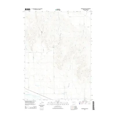
2014 Map of Broadwater NW
USGS Topo · Published 2014About this map
Cedar Canyon defines the northern reaches of this Morrill County landscape, where deeply incised terrain gives way to the irrigation-rich plains of the western Nebraska panhandle. The North Platte River flows through the southern portion of the sheet, paralleled by a complex system of water management infrastructure essential to the region's agricultural life. This network includes the Northport Canal and the winding course of the Browns Cr Canal, which draws from Browns Cr to feed the Covalt Reservoir. Local drainage is further managed by the Silvernail Drain, illustrating how early 21st-century land use in this river valley remains fundamentally tied to water diversion and the control of the North Platte's natural flow.
Find a feature on this map
21 named features on this map. Tap any name to fly to it.
Don’t see what you’re looking for? This feature index may not catch every label — zoom into the map to look around manually.
Map Details
Editions of this 2014 Broadwater NW Map
This is the sole edition of this map. No revisions or reprints were ever made.
Other maps of this area

1896 · Browns Creek
USGS Topo · 1:125,000

1898 · Camp Clarke
USGS Topo · 1:125,000

1899 · Browns Creek
USGS Topo · 1:125,000

1949 · Lynn
USGS Topo · 1:62,500

1954 · Scottsbluff
USGS Topo · 1:250,000

1958 · Scottsbluff
USGS Topo · 1:250,000

1965 · Broadwater
USGS Topo · 1:24,000

1965 · Angora SE
USGS Topo · 1:24,000

1965 · Courthouse Rock
USGS Topo · 1:24,000

1965 · Broadwater NW
USGS Topo · 1:24,000