
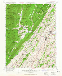
1947 Map of Broadway
USGS Topo · Published 1959About this map
Broadway and Timberville anchor the agricultural and industrial landscape of northern Rockingham County during the late 1940s. The Southern railroad line tracks parallel to the North Fork Shenandoah River, connecting these mill and trade centers to the wider Shenandoah Valley. West of the river, the terrain rises sharply into the George Washington National Forest, where steep ridges like Church Mountain and Cross Mountain are cut by narrow gaps and runs.
Find a feature on this map
129 named features on this map. Tap any name to fly to it.
Don’t see what you’re looking for? This feature index may not catch every label — zoom into the map to look around manually.
Map Details
Editions of this 1947 Broadway Map
2 editions found
Other maps of this area

1892 · Franklin
USGS Topo · 1:125,000

1892 · Woodstock
USGS Topo · 1:125,000

1892 · Harrisonburg
USGS Topo · 1:125,000

1894 · Staunton
USGS Topo · 1:125,000

1896 · Franklin
USGS Topo · 1:125,000

1920 · Petersburg
USGS Topo · 1:48,000

1921 · Orkney Springs
USGS Topo · 1:48,000

1921 · Petersburg
USGS Topo · 1:48,000

1922 · Fort Seybert
USGS Topo · 1:48,000

1922 · Petersburg
USGS Topo · 1:62,500