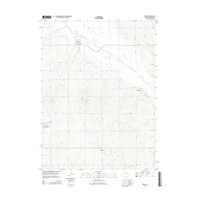
2014 Map of Brock
USGS Topo · Published 2014About this map
Brock and Johnson anchor this agricultural landscape in southeastern Nebraska, where the Little Nemaha River carves a broad valley through the rolling terrain. The map documents a dense network of rural infrastructure, from the small settlement of Glenrock to the southern outpost of Rohrs along Highway 136. Numerous tributaries including Houchen Cr, Longs Cr, and Ord Cr drain the uplands, occasionally collected into water management features like the Gauchat Group Reservoir and Dominey Reservoir. For the local historian or genealogist, the sheet preserves the exact locations of several community burial grounds, including Old Glenrock Cem in the east, Clifton Cem near the center, and Linden Cem further south. These landmarks, along with the section-line road grid like 731 RD and 736 RD, illustrate the persistent spatial organization of Nemaha County's farming communities.
Find a feature on this map
33 named features on this map. Tap any name to fly to it.
Don’t see what you’re looking for? This feature index may not catch every label — zoom into the map to look around manually.
Map Details
Editions of this 2014 Brock Map
This is the sole edition of this map. No revisions or reprints were ever made.
Other maps of this area

1903 · Weeping Water
USGS Topo · 1:125,000

1907 · Nebraska City
USGS Topo · 1:62,500

1915 · Howe
USGS Topo · 1:62,500

1929 · Weeping Water
USGS Topo · 1:125,000

1955 · Nebraska City
USGS Topo · 1:250,000

1955 · Lincoln
USGS Topo · 1:250,000

1957 · Nebraska City
USGS Topo · 1:250,000

1957 · Lincoln
USGS Topo · 1:250,000

1958 · Lincoln
USGS Topo · 1:250,000

1958 · Nebraska City
USGS Topo · 1:250,000