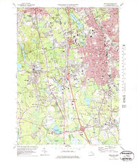
1975 Map of Brockton
USGS Topo · Published 1979About this map
Brockton and its neighboring townships appear here at a mid-century peak of post-war suburban and industrial development. The landscape is defined by a dense grid of residential streets and civic institutions, including the large U S Veterans Administration Hospital and the Cardinal Cushing Hospital. While the urban core of the city is prominent, the surrounding areas of Easton, Stoughton, and West Bridgewater retain their distinct village identities at crossroads like Five Corners and Elm Square.
Find a feature on this map
164 named features on this map. Tap any name to fly to it.
Don’t see what you’re looking for? This feature index may not catch every label — zoom into the map to look around manually.
Map Details
Editions of this 1975 Brockton Map
2 editions found
Other maps of this area

1885 · Abington
USGS Topo · 1:62,500

1885 · Middleboro
USGS Topo · 1:62,500

1885 · Taunton
USGS Topo · 1:62,500

1886 · Dedham
USGS Topo · 1:62,500

1888 · Taunton
USGS Topo · 1:62,500

1888 · Middleboro
USGS Topo · 1:62,500

1888 · Abington
USGS Topo · 1:62,500

1893 · Abington
USGS Topo · 1:62,500

1893 · Taunton
USGS Topo · 1:62,500

1893 · Middleboro
USGS Topo · 1:62,500