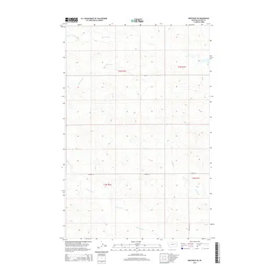
2014 Map of Brockway NE
USGS Topo · Published 2014About this map
Stony Butte Cr and Antelope Cr define the drainage patterns of this rural McCone County landscape, where the high plains of eastern Montana meet a network of seasonal coulees. This 2014 survey captures a vast section of the Public Land Survey System, including portions of t20n r46e, t20n r47e, t19n r46e, and t19n r47e. The infrastructure is sparse, characterized by long-distance routes such as MT-252 and the isolated Mayberry Rd. These corridors provide the primary access to the drainage basins of Horse Cr and its S Fork Horse Cr in the northern reaches of the quadrangle. The map is a vital resource for understanding modern land division and water rights in a region where topography and sparse water sources dictate the placement of roads and homesteads.
Find a feature on this map
11 named features on this map. Tap any name to fly to it.
Don’t see what you’re looking for? This feature index may not catch every label — zoom into the map to look around manually.
Map Details
Editions of this 2014 Brockway NE Map
This is the sole edition of this map. No revisions or reprints were ever made.
Other maps of this area

1954 · Glendive
USGS Topo · 1:250,000

1957 · Glendive
USGS Topo · 1:250,000

1958 · Glendive
USGS Topo · 1:250,000

1982 · Circle
USGS Topo · 1:100,000

1983 · Youngquist Mine
USGS Topo · 1:24,000

1983 · Brockway NE
USGS Topo · 1:24,000

1983 · Haynie Reservoir
USGS Topo · 1:24,000

1983 · North Fork Horse Creek
USGS Topo · 1:24,000
1983 · Brockway
USGS Topo · 1:24,000
1983 · Johnson Coulee East
USGS Topo · 1:24,000