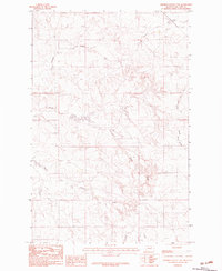
1983 Map of Johnson Coulee East
USGS Topo · Published 1983About this map
Johnson Coulee and the surrounding drainage network of eastern McCone County are recorded here as they appeared during a 1977 field check. The landscape is defined by the complex convergence of creek systems, including Nelson Creek and its South Fork, which carve through the high plains. This provisional survey captures the intricate topographical details of the terrain before later digital transitions, offering a precise look at the land's natural contours and watercourses. Significant landmarks such as Stony Butte rise above the surrounding drainages of Stony Butte Creek and Horse Creek. The map provides an essential record for understanding the hydrological patterns and rangeland geography of this portion of Montana, reflecting the sparse, water-driven settlement patterns of the late twentieth century.
Find a feature on this map
8 named features on this map. Tap any name to fly to it.
Don’t see what you’re looking for? This feature index may not catch every label — zoom into the map to look around manually.
Map Details
Editions of this 1983 Johnson Coulee East Map
This is the sole edition of this map. No revisions or reprints were ever made.
Other maps of this area

1954 · Jordan
USGS Topo · 1:250,000

1954 · Glendive
USGS Topo · 1:250,000

1956 · Jordan
USGS Topo · 1:250,000

1957 · Glendive
USGS Topo · 1:250,000

1958 · Jordan
USGS Topo · 1:250,000

1958 · Glendive
USGS Topo · 1:250,000

1964 · Jordan
USGS Topo · 1:250,000

1973 · Rodgers Hall
USGS Topo · 1:24,000

1978 · Fort Peck Lake East
USGS Topo · 1:100,000

1982 · Circle
USGS Topo · 1:100,000