
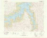
1978 Map of Fort Peck Lake East
USGS Topo · Published 1978About this map
Charles M Russell National Wildlife Range dominates this landscape, encompassing the intricate, branching shoreline of Fort Peck Lake and the Missouri River. The map reveals a post-dam environment where the rising waters of the lake have filled numerous coulees and canyons, creating a complex geography of inlets like Hell Creek Bay and the elongated Dry Arm. This era shows the intersection of federal conservation efforts and the remnant infrastructure of rural life in Garfield County.
Find a feature on this map
106 named features on this map. Tap any name to fly to it.
Don’t see what you’re looking for? This feature index may not catch every label — zoom into the map to look around manually.
Map Details
Editions of this 1978 Fort Peck Lake East Map
2 editions found
Other maps of this area

1914 · Nashua
USGS Topo · 1:62,500

1915 · Frazer
USGS Topo · 1:62,500

1915 · Oswego
USGS Topo · 1:62,500

1916 · Nashua
USGS Topo · 1:62,500

1943 · Glasgow
USGS Topo · 1:125,000

1954 · Jordan
USGS Topo · 1:250,000

1954 · Glendive
USGS Topo · 1:250,000

1954 · Wolf Point
USGS Topo · 1:250,000

1954 · Glasgow
USGS Topo · 1:250,000

1956 · Jordan
USGS Topo · 1:250,000