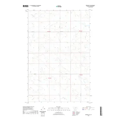
2020 Map of Brockway NE
USGS Topo · Published 2020About this map
Stony Butte Creek and its namesake drainage, Stony Butte Cr, define the southern landscape of this McCone County region. The topography is characterized by a network of seasonal coulees and creek beds, including Antelope Cr and the upper reaches of Horse Creek. Rural connectivity is provided by a simple grid of gravel roads such as Weldon Rd and Horse Creek Rd, which intersect across the township boundaries of t20n r46e and t20n r47e. The map reflects a modern inventory of the area's natural hydrography, showing how S Fork Horse Cr and other tributaries carve through the sectioned plains. This 2020 survey is an essential reference for understanding contemporary land use and the persistent drainage patterns that have shaped ranching and travel in this part of Montana for decades.
Find a feature on this map
14 named features on this map. Tap any name to fly to it.
Don’t see what you’re looking for? This feature index may not catch every label — zoom into the map to look around manually.
Map Details
Editions of this 2020 Brockway NE Map
This is the sole edition of this map. No revisions or reprints were ever made.
Other maps of this area

1954 · Glendive
USGS Topo · 1:250,000

1957 · Glendive
USGS Topo · 1:250,000

1958 · Glendive
USGS Topo · 1:250,000

1982 · Circle
USGS Topo · 1:100,000

1983 · Youngquist Mine
USGS Topo · 1:24,000

1983 · Brockway NE
USGS Topo · 1:24,000

1983 · Haynie Reservoir
USGS Topo · 1:24,000

1983 · North Fork Horse Creek
USGS Topo · 1:24,000
1983 · Brockway
USGS Topo · 1:24,000
1983 · Johnson Coulee East
USGS Topo · 1:24,000