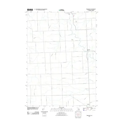
2011 Map of Brockway
USGS Topo · Published 2011About this map
Mill Creek winds through the agricultural landscape of northern Saint Clair County, serving as the central drainage for a network of named waterways including Sheehy Drain and Thody Drain. The city of Yale occupies the northwestern corner of the area, defined by its proximity to Yale Airport and the convergence of several rural thoroughfares. Further south, the settlement of Brockway sits along the creek, while Emmett anchors the southern boundary near the Pine River. This 2011 survey reveals a highly organized grid of section roads, such as Imlay City Rd and Metcalf Rd, that delineate the legacy of Michigan’s rural township structure. For researchers, the inclusion of the Moore Cemetery and numerous family-named drains like the Meharg Drain and Gleason Drain provides essential reference points for tracing early land divisions and community development within this fertile pocket of the Thumb region.
Find a feature on this map
53 named features on this map. Tap any name to fly to it.
Don’t see what you’re looking for? This feature index may not catch every label — zoom into the map to look around manually.
Map Details
Editions of this 2011 Brockway Map
This is the sole edition of this map. No revisions or reprints were ever made.
Other maps of this area

1914 · Armada
USGS Topo · 1:62,500

1928 · Armada
USGS Topo · 1:62,500

1928 · Hicky
USGS Topo · 1:62,500

1939 · Goodells
USGS Topo · 1:24,000

1944 · Memphis
USGS Topo · 1:24,000

1945 · Allenton
USGS Topo · 1:24,000

1952 · Allenton
USGS Topo · 1:24,000

1952 · Memphis
USGS Topo · 1:24,000
1952 · Goodells
USGS Topo · 1:24,000

1954 · Detroit
USGS Topo · 1:250,000