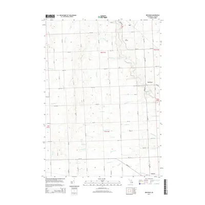
2014 Map of Brockway
USGS Topo · Published 2014About this map
The northern reaches of Saint Clair County are defined by a complex network of agricultural drainage systems, where the terrain transitions toward the Pine River and Mill Creek watersheds. The settlement of Brockway sits at a crossroads of early transit routes like Metcalf Rd and Emmett Rd, while the larger town of Yale occupies the northeastern corner of this survey. This landscape is a patchwork of rural township lines, including T8N R14E and T7N R15E, reflecting the late 19th-century land division that shaped Michigan's Thumb region. Local heritage is marked by small landmarks like Moore Cem and the Yale Airport, which contrast with the intricate hydrologic network of White Drain, Quakenbush Drain, and Sheehy Drain. These named channels illustrate the extensive engineering required to convert this area's natural wetlands into productive farmland.
Find a feature on this map
67 named features on this map. Tap any name to fly to it.
Don’t see what you’re looking for? This feature index may not catch every label — zoom into the map to look around manually.
Map Details
Editions of this 2014 Brockway Map
This is the sole edition of this map. No revisions or reprints were ever made.
Other maps of this area

1914 · Armada
USGS Topo · 1:62,500

1928 · Armada
USGS Topo · 1:62,500

1928 · Hicky
USGS Topo · 1:62,500

1939 · Goodells
USGS Topo · 1:24,000

1944 · Memphis
USGS Topo · 1:24,000

1945 · Allenton
USGS Topo · 1:24,000

1952 · Allenton
USGS Topo · 1:24,000

1952 · Memphis
USGS Topo · 1:24,000
1952 · Goodells
USGS Topo · 1:24,000

1954 · Detroit
USGS Topo · 1:250,000