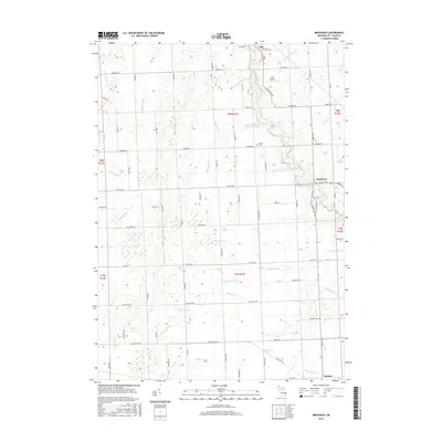
2017 Map of Brockway
USGS Topo · Published 2017About this map
Agricultural lands and complex drainage systems define this part of Saint Clair County, anchored by the settlements of Yale and Brockway. The terrain is marked by an extensive network of named waterways, including the Mill Creek and the Pine River, which flow alongside numerous man-made channels like the Quakenbush Drain and Popplewell Drain. These drains reflect the historical engineering required to manage the low-lying geography for farming. Transport routes like Imlay City Rd and Old State Hwy 21 provide the primary east-west corridors, while the Yale Airport serves as a small aviation hub for the local area. Genealogists may find interest in the Moore Cem, located centrally between the major roads and watercourses. Farther south, the small community of Emmett sits near the Emmett Drain, illustrating the tight relationship between these settlements and their local watersheds during the mid-2010s.
Find a feature on this map
80 named features on this map. Tap any name to fly to it.
Don’t see what you’re looking for? This feature index may not catch every label — zoom into the map to look around manually.
Map Details
Editions of this 2017 Brockway Map
This is the sole edition of this map. No revisions or reprints were ever made.
Other maps of this area

1914 · Armada
USGS Topo · 1:62,500

1928 · Armada
USGS Topo · 1:62,500

1928 · Hicky
USGS Topo · 1:62,500

1939 · Goodells
USGS Topo · 1:24,000

1944 · Memphis
USGS Topo · 1:24,000

1945 · Allenton
USGS Topo · 1:24,000

1952 · Allenton
USGS Topo · 1:24,000

1952 · Memphis
USGS Topo · 1:24,000
1952 · Goodells
USGS Topo · 1:24,000

1954 · Detroit
USGS Topo · 1:250,000