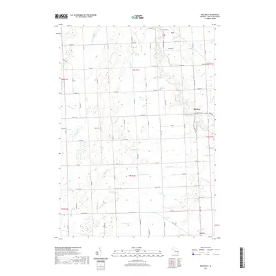
2019 Map of Brockway
USGS Topo · Published 2019About this map
The agricultural heart of Brockway Township is defined by an intricate network of man-made and natural waterways that sustain the Saint Clair County landscape. The city of Yale occupies the northern reaches, supported by the Yale Airport, while the village of Emmett anchors the southern border. The terrain is crisscrossed by numerous irrigation and drainage channels, including the Quakenbush Drain, Gleason Drain, and Sheehy Drain, which feed into larger water bodies like the Pine River and Mill Creek. These features illustrate the intensive land management required for local farming.
Find a feature on this map
81 named features on this map. Tap any name to fly to it.
Don’t see what you’re looking for? This feature index may not catch every label — zoom into the map to look around manually.
Map Details
Editions of this 2019 Brockway Map
This is the sole edition of this map. No revisions or reprints were ever made.
Other maps of this area

1914 · Armada
USGS Topo · 1:62,500

1928 · Armada
USGS Topo · 1:62,500

1928 · Hicky
USGS Topo · 1:62,500

1939 · Goodells
USGS Topo · 1:24,000

1944 · Memphis
USGS Topo · 1:24,000

1945 · Allenton
USGS Topo · 1:24,000

1952 · Allenton
USGS Topo · 1:24,000

1952 · Memphis
USGS Topo · 1:24,000
1952 · Goodells
USGS Topo · 1:24,000

1954 · Detroit
USGS Topo · 1:250,000